11
views
0
recommends
+1 Recommend
0 collections
    0
    shares
      • Record: found
      • Abstract: found
      • Article: found
      Is Open Access

      Geostatistical analysis and mapping of malaria risk in children under 5 using point-referenced prevalence data in Ghana

      research-article

      Read this article at

      Bookmark
          There is no author summary for this article yet. Authors can add summaries to their articles on ScienceOpen to make them more accessible to a non-specialist audience.

          Abstract

          Background

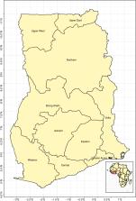
          Malaria remains a major challenge in sub-Saharan Africa and Ghana is not an exception. Effective malaria transmission control requires evidence-based targeting and utilization of resources. Disease risk mapping provides an effective and efficient tool for monitoring transmission and control efforts. The aim of this study is to analyse and map malaria risk in children under 5 years old, with the ultimate goal of identifying areas where control efforts can be targeted.

          Methods

          Data collected from the 2016 Ghana demographic and health survey was analyzed. Binomial logistic regression was applied to examine the determinants of malaria risk among children. Model-based geostatistical methods were applied to analyze, predict and map malaria prevalence.

          Results

          There is a significant association of malaria prevalence with area of residence (rural/urban), age, indoor residual spray use, social economic status and mother’s education level. Overall, parasitaemia prevalence among children under 5 years old for the year 2016 is low albeit characterized by “hotspots” in specific areas.

          Conclusion

          The risk maps indicate the spatial heterogeneity of malaria prevalence. The high resolution maps can serve as an effective tool in the identification of locations that require targeted interventions by programme implementers; this is key and relevant for reducing malaria burden in Ghana.

          Related collections

          Most cited references51

          • Record: found
          • Abstract: found
          • Article: not found

          Urbanization, malaria transmission and disease burden in Africa.

          Many attempts have been made to quantify Africa's malaria burden but none has addressed how urbanization will affect disease transmission and outcome, and therefore mortality and morbidity estimates. In 2003, 39% of Africa's 850 million people lived in urban settings; by 2030, 54% of Africans are expected to do so. We present the results of a series of entomological, parasitological and behavioural meta-analyses of studies that have investigated the effect of urbanization on malaria in Africa. We describe the effect of urbanization on both the impact of malaria transmission and the concomitant improvements in access to preventative and curative measures. Using these data, we have recalculated estimates of populations at risk of malaria and the resulting mortality. We find there were 1,068,505 malaria deaths in Africa in 2000 - a modest 6.7% reduction over previous iterations. The public-health implications of these findings and revised estimates are discussed.
            Bookmark
            • Record: found
            • Abstract: not found
            • Article: not found

            Model-based geostatistics

              Bookmark
              • Record: found
              • Abstract: not found
              • Article: not found

              Heterogeneities in the transmission of infectious agents: Implications for the design of control programs

                Bookmark

                Author and article information

                Contributors
                ryankson@aims.edu.gh
                evelyn@aims.edu.gh
                mgchipeta@mlw.mw
                Journal
                Malar J
                Malar. J
                Malaria Journal
                BioMed Central (London )
                1475-2875
                11 March 2019
                11 March 2019
                2019
                : 18
                : 67
                Affiliations
                [1 ]ISNI 0000 0004 4657 4181, GRID grid.494523.d, African Institute of Mathematical Sciences, ; Accra-Cape Coast Road, Adisadel, Cape Coast, Ghana
                [2 ]GRID grid.419393.5, Malawi-Liverpool Wellcome Trust Research Programme, ; Queen Elizabeth Central Hospital, Blantyre, Malawi
                Article
                2709
                10.1186/s12936-019-2709-y
                6419518
                30871551
                e823bc4d-e8ce-49e6-ad5b-730a48ffdcd8
                © The Author(s) 2019

                Open AccessThis article is distributed under the terms of the Creative Commons Attribution 4.0 International License ( http://creativecommons.org/licenses/by/4.0/), which permits unrestricted use, distribution, and reproduction in any medium, provided you give appropriate credit to the original author(s) and the source, provide a link to the Creative Commons license, and indicate if changes were made. The Creative Commons Public Domain Dedication waiver ( http://creativecommons.org/publicdomain/zero/1.0/) applies to the data made available in this article, unless otherwise stated.

                History
                : 13 November 2018
                : 6 March 2019
                Categories
                Research
                Custom metadata
                © The Author(s) 2019

                Infectious disease & Microbiology
                malaria,hotspot,mapping,geostatistics,exceedance probability
                Infectious disease & Microbiology
                malaria, hotspot, mapping, geostatistics, exceedance probability

                Comments

                Comment on this article