4
views
0
recommends
+1 Recommend
1 collections
    0
    shares
      • Record: found
      • Abstract: found
      • Article: found
      Is Open Access

      Multiscale dynamic human mobility flow dataset in the U.S. during the COVID-19 epidemic

      data-paper

      Read this article at

      Bookmark
          There is no author summary for this article yet. Authors can add summaries to their articles on ScienceOpen to make them more accessible to a non-specialist audience.

          Abstract

          Understanding dynamic human mobility changes and spatial interaction patterns at different geographic scales is crucial for assessing the impacts of non-pharmaceutical interventions (such as stay-at-home orders) during the COVID-19 pandemic. In this data descriptor, we introduce a regularly-updated multiscale dynamic human mobility flow dataset across the United States, with data starting from March 1st, 2020. By analysing millions of anonymous mobile phone users’ visits to various places provided by SafeGraph, the daily and weekly dynamic origin-to-destination (O-D) population flows are computed, aggregated, and inferred at three geographic scales: census tract, county, and state. There is high correlation between our mobility flow dataset and openly available data sources, which shows the reliability of the produced data. Such a high spatiotemporal resolution human mobility flow dataset at different geographic scales over time may help monitor epidemic spreading dynamics, inform public health policy, and deepen our understanding of human behaviour changes under the unprecedented public health crisis. This up-to-date O-D flow open data can support many other social sensing and transportation applications.

          Abstract

          Measurement(s) mobility • Interaction
          Technology Type(s) GPS navigation system • machine learning
          Factor Type(s) geographic scale • temporal interval • geographic location • spatiotemporal region
          Sample Characteristic - Location United States of America

          Machine-accessible metadata file describing the reported data: 10.6084/m9.figshare.13135085

          Related collections

          Most cited references28

          • Record: found
          • Abstract: found
          • Article: not found

          An interactive web-based dashboard to track COVID-19 in real time

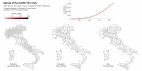
          In December, 2019, a local outbreak of pneumonia of initially unknown cause was detected in Wuhan (Hubei, China), and was quickly determined to be caused by a novel coronavirus, 1 namely severe acute respiratory syndrome coronavirus 2 (SARS-CoV-2). The outbreak has since spread to every province of mainland China as well as 27 other countries and regions, with more than 70 000 confirmed cases as of Feb 17, 2020. 2 In response to this ongoing public health emergency, we developed an online interactive dashboard, hosted by the Center for Systems Science and Engineering (CSSE) at Johns Hopkins University, Baltimore, MD, USA, to visualise and track reported cases of coronavirus disease 2019 (COVID-19) in real time. The dashboard, first shared publicly on Jan 22, illustrates the location and number of confirmed COVID-19 cases, deaths, and recoveries for all affected countries. It was developed to provide researchers, public health authorities, and the general public with a user-friendly tool to track the outbreak as it unfolds. All data collected and displayed are made freely available, initially through Google Sheets and now through a GitHub repository, along with the feature layers of the dashboard, which are now included in the Esri Living Atlas. The dashboard reports cases at the province level in China; at the city level in the USA, Australia, and Canada; and at the country level otherwise. During Jan 22–31, all data collection and processing were done manually, and updates were typically done twice a day, morning and night (US Eastern Time). As the outbreak evolved, the manual reporting process became unsustainable; therefore, on Feb 1, we adopted a semi-automated living data stream strategy. Our primary data source is DXY, an online platform run by members of the Chinese medical community, which aggregates local media and government reports to provide cumulative totals of COVID-19 cases in near real time at the province level in China and at the country level otherwise. Every 15 min, the cumulative case counts are updated from DXY for all provinces in China and for other affected countries and regions. For countries and regions outside mainland China (including Hong Kong, Macau, and Taiwan), we found DXY cumulative case counts to frequently lag behind other sources; we therefore manually update these case numbers throughout the day when new cases are identified. To identify new cases, we monitor various Twitter feeds, online news services, and direct communication sent through the dashboard. Before manually updating the dashboard, we confirm the case numbers with regional and local health departments, including the respective centres for disease control and prevention (CDC) of China, Taiwan, and Europe, the Hong Kong Department of Health, the Macau Government, and WHO, as well as city-level and state-level health authorities. For city-level case reports in the USA, Australia, and Canada, which we began reporting on Feb 1, we rely on the US CDC, the government of Canada, the Australian Government Department of Health, and various state or territory health authorities. All manual updates (for countries and regions outside mainland China) are coordinated by a team at Johns Hopkins University. The case data reported on the dashboard aligns with the daily Chinese CDC 3 and WHO situation reports 2 for within and outside of mainland China, respectively (figure ). Furthermore, the dashboard is particularly effective at capturing the timing of the first reported case of COVID-19 in new countries or regions (appendix). With the exception of Australia, Hong Kong, and Italy, the CSSE at Johns Hopkins University has reported newly infected countries ahead of WHO, with Hong Kong and Italy reported within hours of the corresponding WHO situation report. Figure Comparison of COVID-19 case reporting from different sources Daily cumulative case numbers (starting Jan 22, 2020) reported by the Johns Hopkins University Center for Systems Science and Engineering (CSSE), WHO situation reports, and the Chinese Center for Disease Control and Prevention (Chinese CDC) for within (A) and outside (B) mainland China. Given the popularity and impact of the dashboard to date, we plan to continue hosting and managing the tool throughout the entirety of the COVID-19 outbreak and to build out its capabilities to establish a standing tool to monitor and report on future outbreaks. We believe our efforts are crucial to help inform modelling efforts and control measures during the earliest stages of the outbreak.
            Bookmark
            • Record: found
            • Abstract: found
            • Article: found
            Is Open Access

            Spread and dynamics of the COVID-19 epidemic in Italy: Effects of emergency containment measures

            Significance The ongoing pandemic of COVID-19 challenges globalized societies. Scientific and technological cross-fertilization yields broad availability of georeferenced epidemiological data and of modeling tools that aid decisions on emergency management. To this end, spatially explicit models of the COVID-19 epidemic that include e.g. regional individual mobilities, the progression of social distancing, and local capacity of medical infrastructure provide significant information. Data-tailored spatial resolutions that model the disease spread geography can include details of interventions at the proper geographical scale. Based on them, it is possible to quantify the effect of local containment measures (like diachronic spatial maps of averted hospitalizations) and the assessment of the spatial and temporal planning of the needs of emergency measures and medical infrastructure as a major contingency planning aid.
              Bookmark
              • Record: found
              • Abstract: found
              • Article: not found

              Understanding individual human mobility patterns.

              Despite their importance for urban planning, traffic forecasting and the spread of biological and mobile viruses, our understanding of the basic laws governing human motion remains limited owing to the lack of tools to monitor the time-resolved location of individuals. Here we study the trajectory of 100,000 anonymized mobile phone users whose position is tracked for a six-month period. We find that, in contrast with the random trajectories predicted by the prevailing Lévy flight and random walk models, human trajectories show a high degree of temporal and spatial regularity, each individual being characterized by a time-independent characteristic travel distance and a significant probability to return to a few highly frequented locations. After correcting for differences in travel distances and the inherent anisotropy of each trajectory, the individual travel patterns collapse into a single spatial probability distribution, indicating that, despite the diversity of their travel history, humans follow simple reproducible patterns. This inherent similarity in travel patterns could impact all phenomena driven by human mobility, from epidemic prevention to emergency response, urban planning and agent-based modelling.
                Bookmark

                Author and article information

                Contributors
                song.gao@wisc.edu
                Journal
                Sci Data
                Sci Data
                Scientific Data
                Nature Publishing Group UK (London )
                2052-4463
                12 November 2020
                12 November 2020
                2020
                : 7
                : 390
                Affiliations
                [1 ]GRID grid.14003.36, ISNI 0000 0001 2167 3675, GeoDS Lab, Department of Geography, , University of Wisconsin-Madison, ; Madison, WI 53706 United States
                [2 ]GRID grid.9227.e, ISNI 0000000119573309, Institute of Geographic Sciences and Natural Resources Research, , Chinese Academy of Sciences, ; Beijing, 100101 China
                [3 ]GRID grid.263488.3, ISNI 0000 0001 0472 9649, School of Architecture and Urban Planning, , Shenzhen University, ; Shenzhen, 518061 China
                Author information
                http://orcid.org/0000-0003-4359-6302
                http://orcid.org/0000-0003-0779-4432
                Article
                734
                10.1038/s41597-020-00734-5
                7661515
                33184280
                394444aa-d3c0-4493-8464-aaf010b90e1b
                © The Author(s) 2020

                Open Access This article is licensed under a Creative Commons Attribution 4.0 International License, which permits use, sharing, adaptation, distribution and reproduction in any medium or format, as long as you give appropriate credit to the original author(s) and the source, provide a link to the Creative Commons license, and indicate if changes were made. The images or other third party material in this article are included in the article’s Creative Commons license, unless indicated otherwise in a credit line to the material. If material is not included in the article’s Creative Commons license and your intended use is not permitted by statutory regulation or exceeds the permitted use, you will need to obtain permission directly from the copyright holder. To view a copy of this license, visit http://creativecommons.org/licenses/by/4.0/.

                The Creative Commons Public Domain Dedication waiver http://creativecommons.org/publicdomain/zero/1.0/ applies to the metadata files associated with this article.

                History
                : 24 June 2020
                : 20 October 2020
                Funding
                Funded by: FundRef https://doi.org/10.13039/100000001, National Science Foundation (NSF);
                Award ID: 2027375
                Award Recipient :
                Categories
                Data Descriptor
                Custom metadata
                © The Author(s) 2020

                socioeconomic scenarios,infectious diseases,geography

                Comments

                Comment on this article